The Gold Standard in Ecological Mapping
The Global Airborne Observatory (GAO) isn't just an aircraft. It is an advanced, globally deployed technological ecosystem built to bridge the gap between heavy physics and immediate conservation intervention.
For two decades, we have provided environmental ministries, space agencies, and global conservation coalitions with the continuous, wall-to-wall data required to make high-stakes, landscape-scale decisions. From mapping cellular canopy traits to tracking marine architecture and greenhouse gas emissions, we don't just see ecosystems—we reveal their structural and biochemical reality, translating raw photons into absolute truth for decision-makers worldwide.

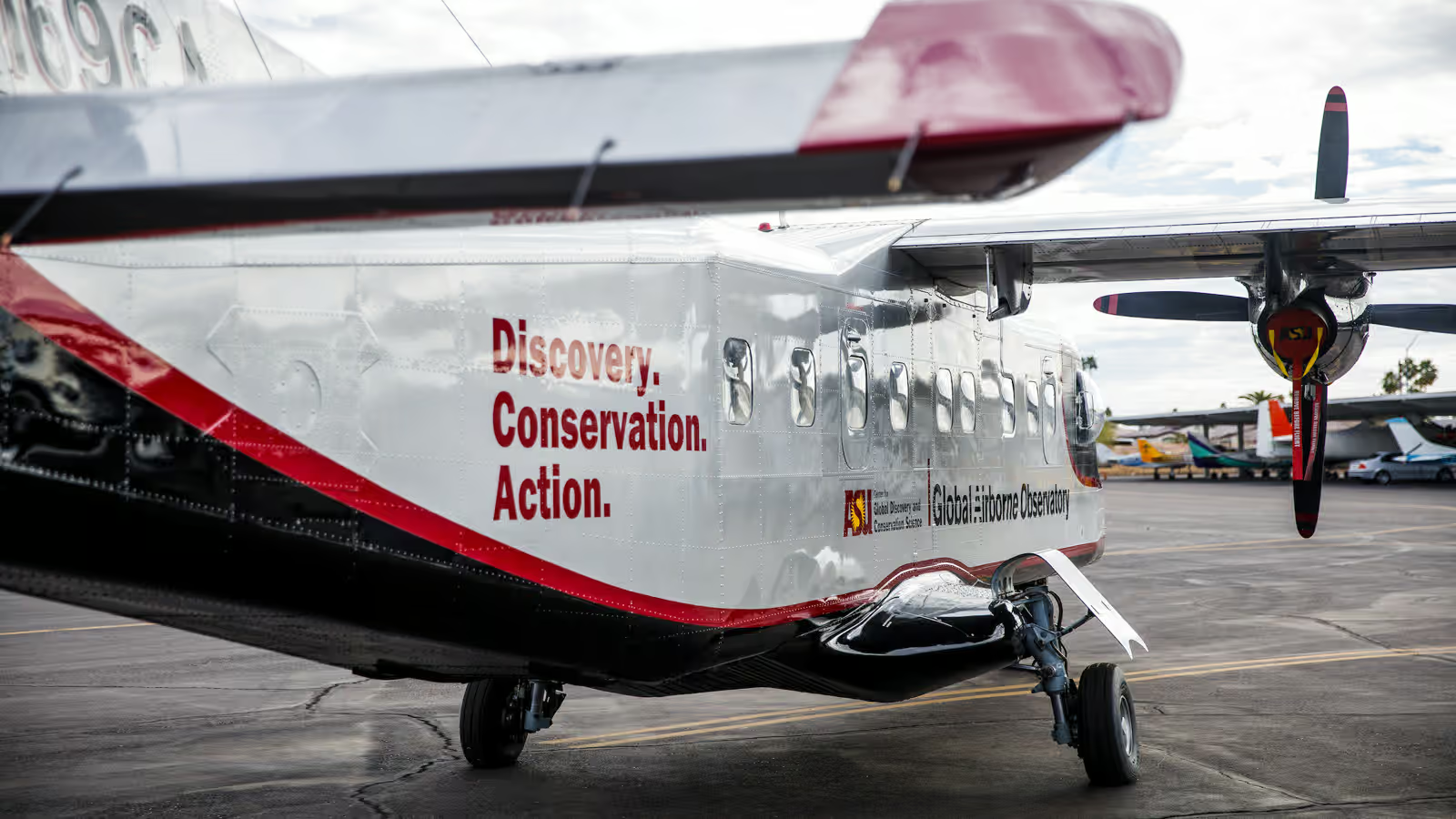
Discovery. Conservation. Action.
These three words are painted on the tail of our aircraft. They represent the core philosophy and linear sequence of our entire program.
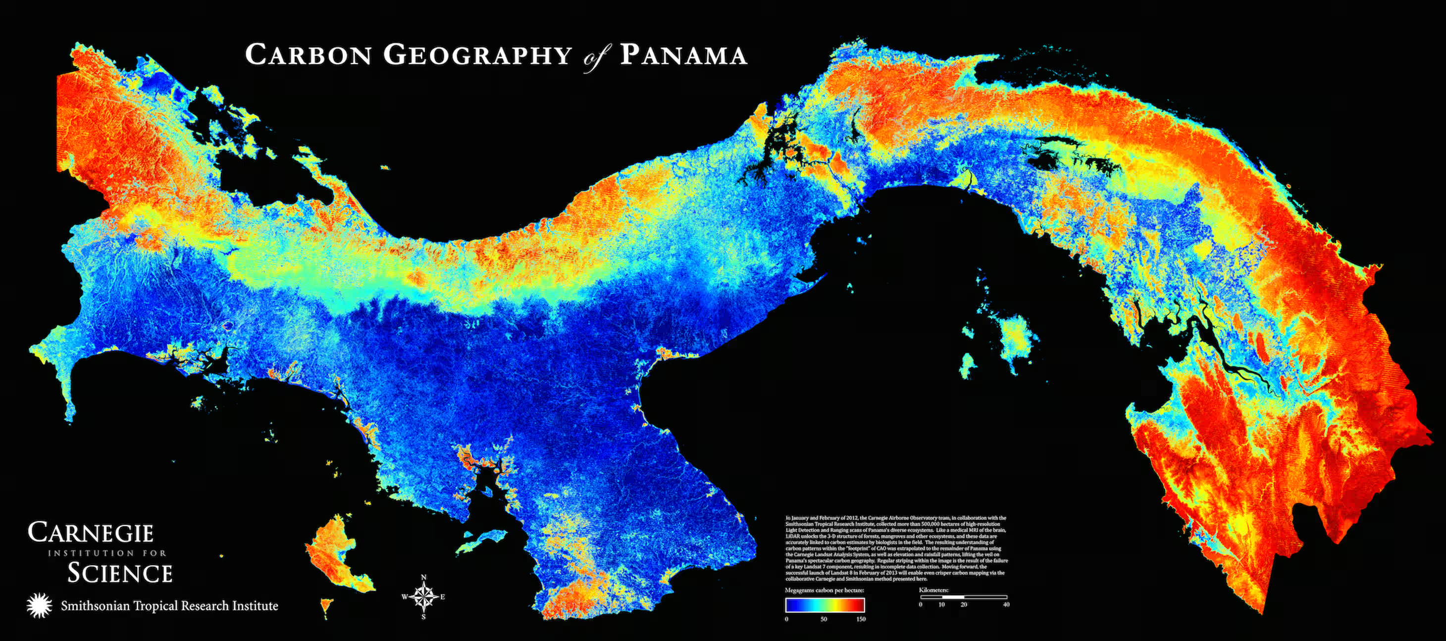
Mapping the Invisible
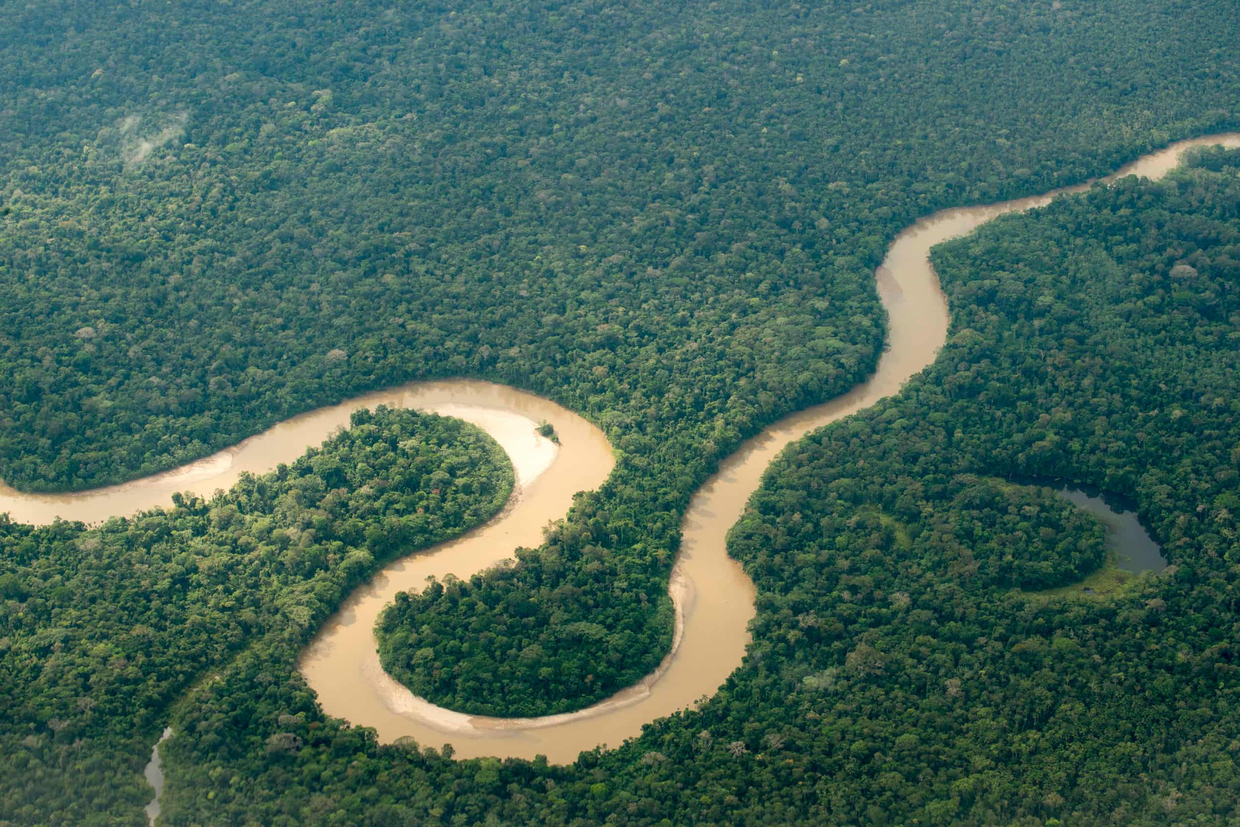
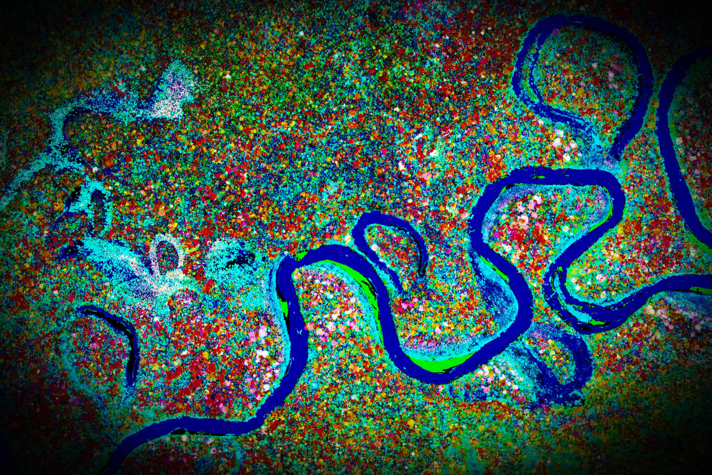
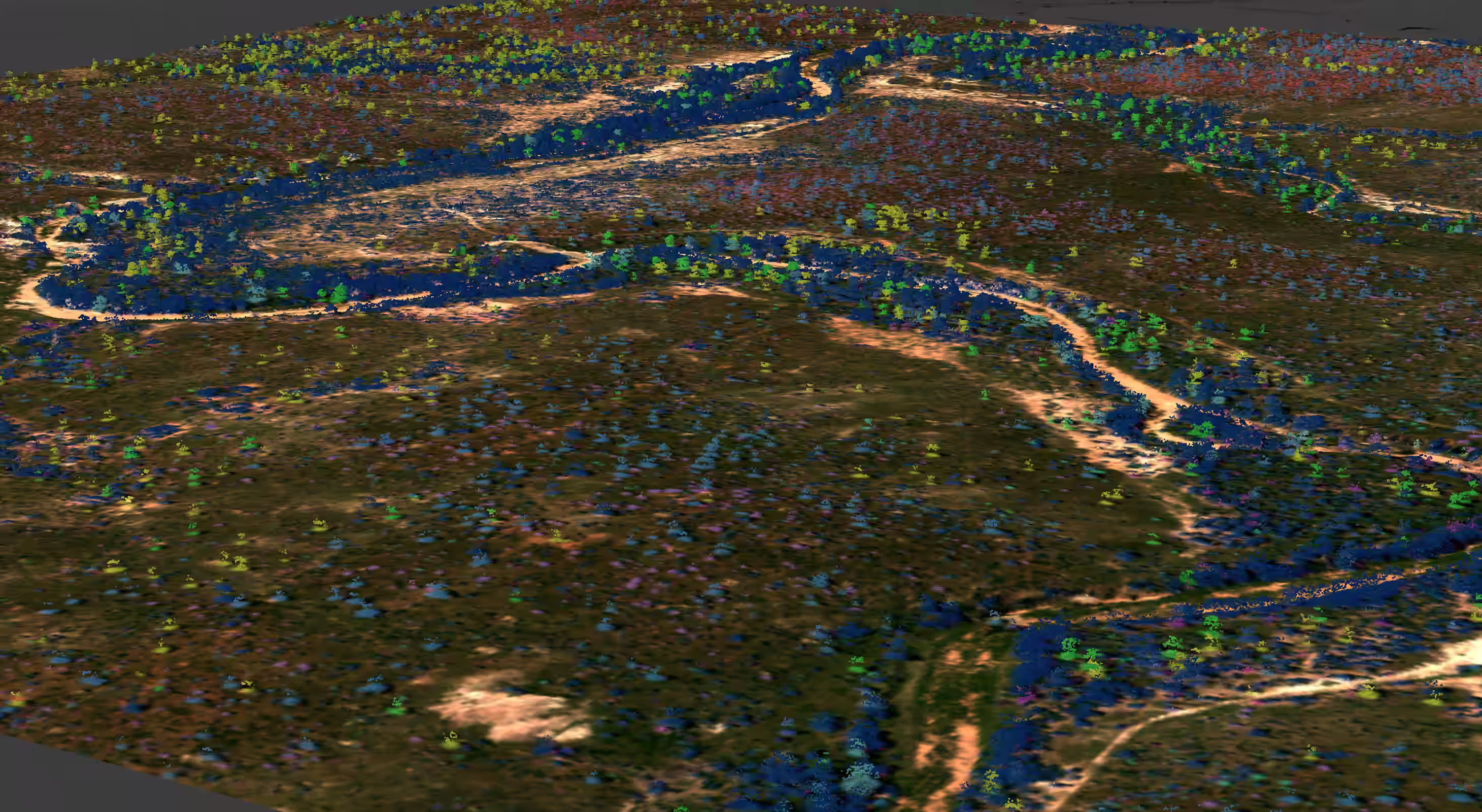
Knowing what resources exist. You cannot protect an ecosystem or mitigate an environmental threat if you do not know its exact spatial and chemical reality. By merging guided dual-laser LiDAR point clouds with high-fidelity imaging spectroscopy, the GAO extracts the structural and biochemical signatures of entire landscapes wall-to-wall.
The Granular Blueprint
Deciding what to do. This does not mean trying to save everything blindly; it means having the granular, continuous data necessary to make high-stakes choices and focus limited intervention resources. We isolate chemical stress markers, map active invasion fronts, and track habitat degradation to give managers a definitive tactical plan.
Defensive Intervention
Taking the final step to create concrete, measurable outcomes on the ground and in the water. We put our datasets directly into the hands of environmental ministries, field crews, and marine teams—translating raw photons into immediate physical results, from sealing localized methane leaks to outplanting climate-resilient coral reefs.
From a Piper Navajo to a Global Observatory
The GAO was born out of frustration. In 1993, while trying to map endemic and invasive species in Hawaiʻi, Greg Asner realized the necessary technology simply did not exist. Existing satellite and aerial tools failed to provide species-level detail.
He went back to graduate school to invent a new pathway for mapping. By 2006, Asner and Robin Martin achieved a massive breakthrough in Kauaʻi, confirming their technology could finally differentiate individual species from the air.
What started in 2006 with a small Piper Navajo aircraft has evolved into a permanent global institution flying a highly advanced Dornier 228. Today, the GAO serves as the premier airborne proving ground to validate, calibrate, and baseline next-generation global satellite constellations from orbit.
Airborne Precision Requires Ground-Level Grit
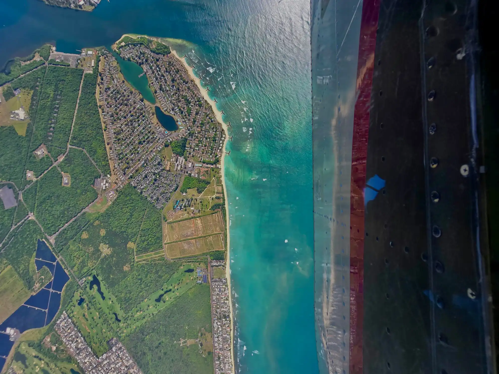
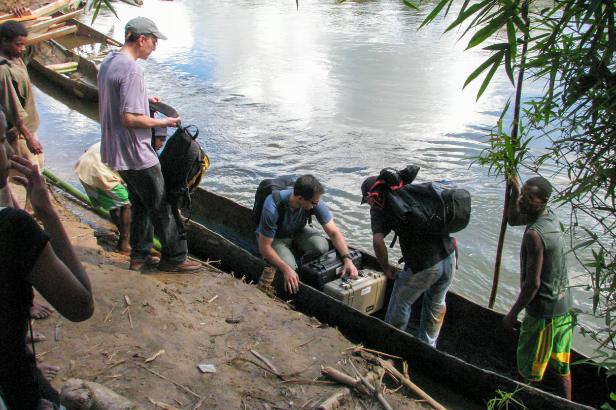
The aircraft is merely the scaffolding. While the observatory flies at 10,000 feet, the data it collects is only as good as the ground truth beneath it. To verify what the sensors see, our team trades the tarmac for wooden canoes, dense jungles, and the ocean floor. This is the Spectronomics field program—an intense, globe-spanning effort to physically catalog the extreme environments we map from the sky.
Terrestrial Expeditions
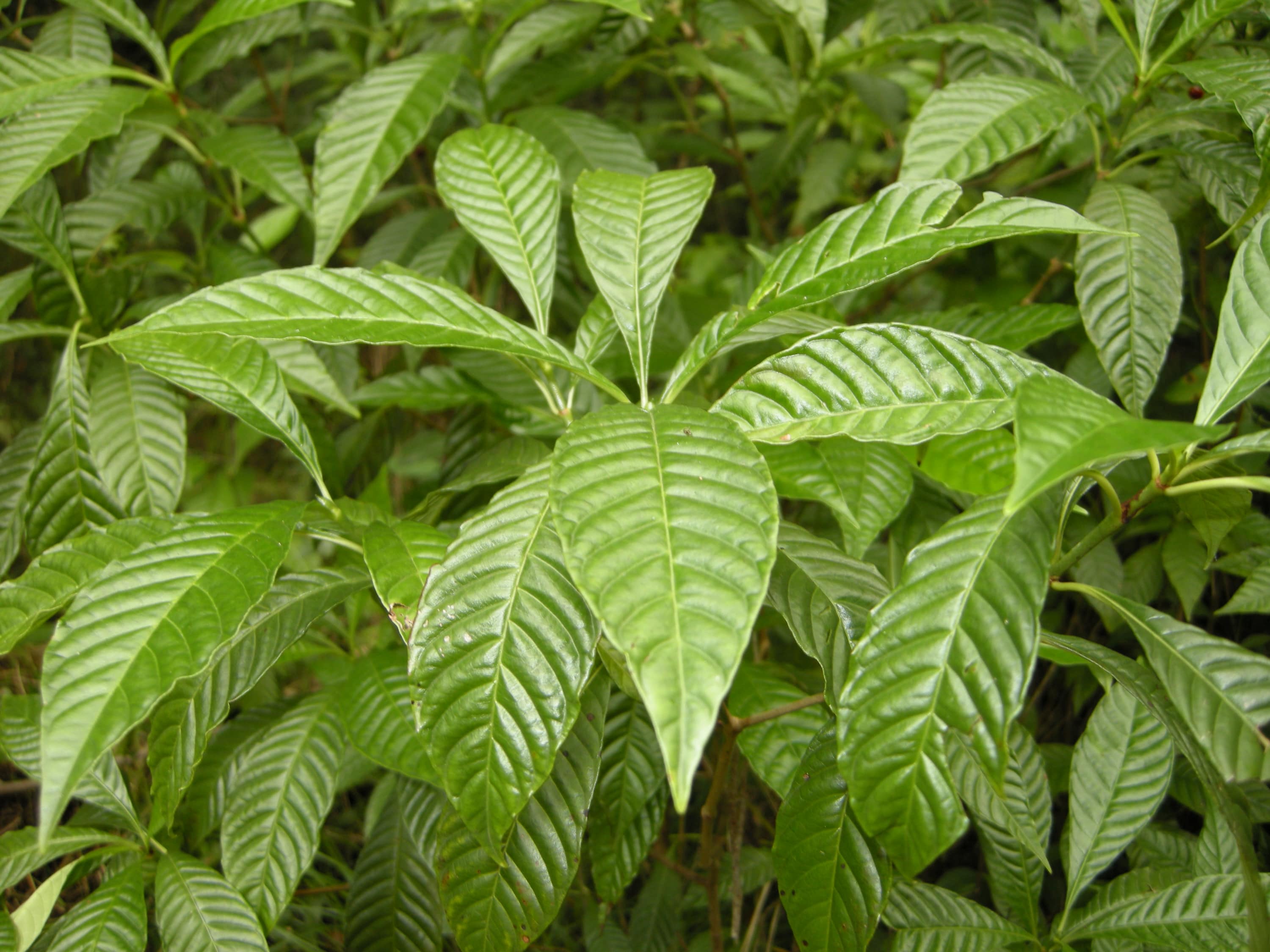
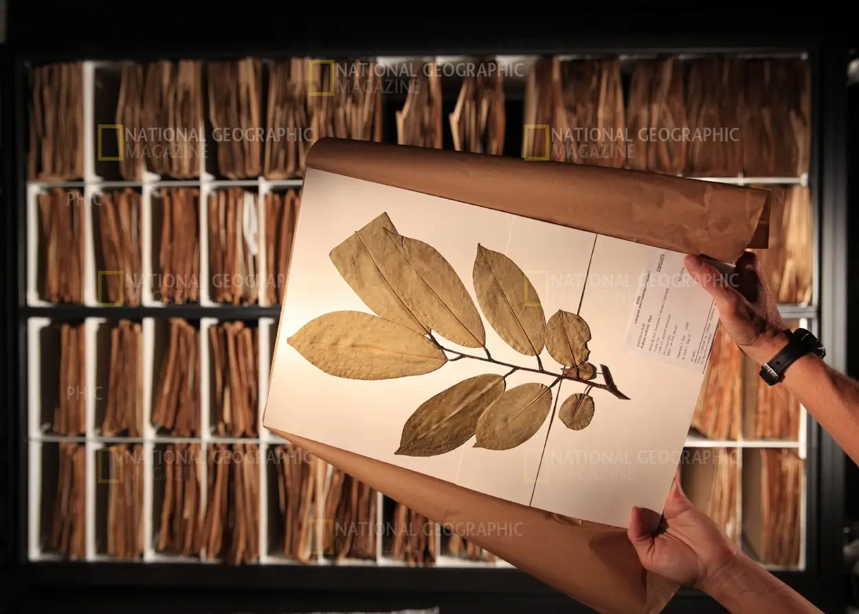
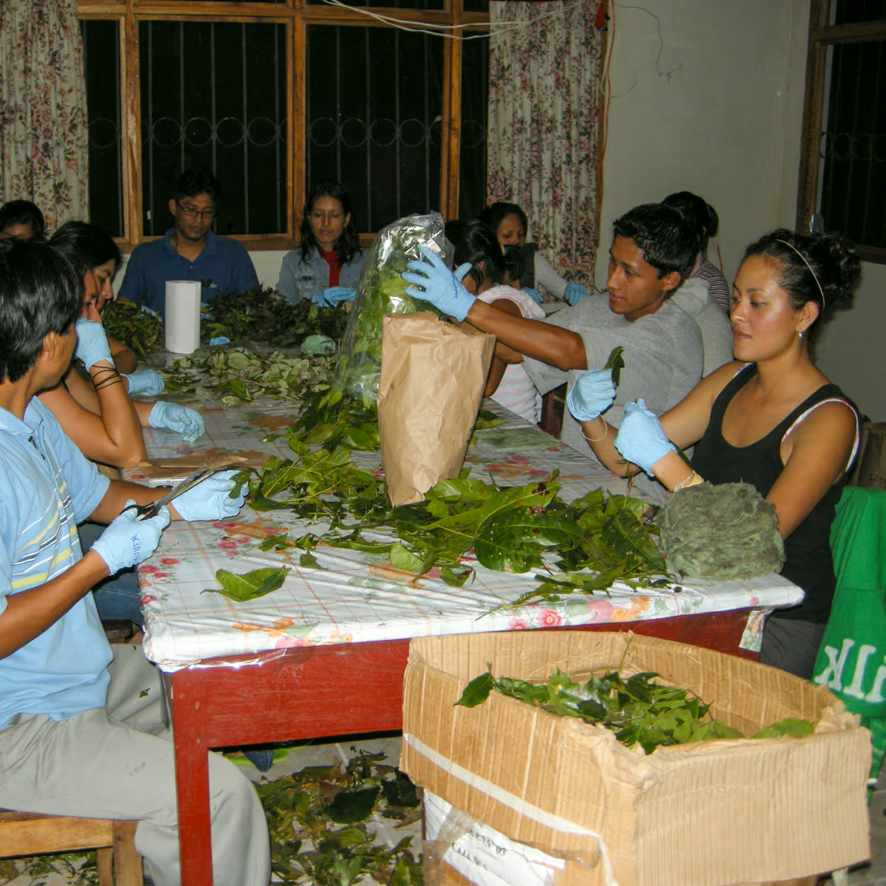
Directed by Greg Asner, this effort involves deploying into some of the most remote environments on Earth to measure the optical signatures of ecosystems right where they live. Together, the field team has climbed roughly 20,000 trees across the globe, securing leaves in cryocoolers, and racing ahead of bulldozers in Madagascar to build a massive 3.5 million-sample database.
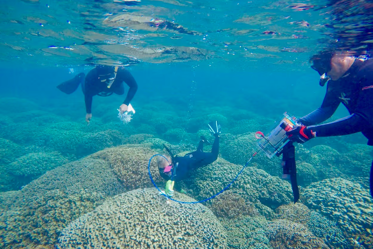
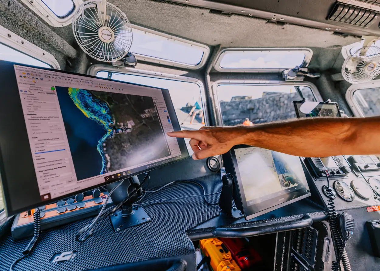
Marine Ground-Truthing
Directed by Robin Martin, this side of the program decodes the physical makeup of ecosystems. While much of her work involves processing physical plant vouchers, her fieldwork extends deep into the ocean. She dives to conduct high-resolution photogrammetry of coral reefs—physically ground-truthing the aerial data and cracking the chemical code required to successfully map living versus dead coral through the water column.
Training the Next Generation
We are incredibly proud of the conservation outcomes the GAO has facilitated, but our greatest legacy is the human one.
The GAO has trained and mentored hundreds of individuals. We have supervised roughly 50 to 60 PhD students who now hold faculty positions and leadership roles at universities globally.
Beyond academia, GAO alumni serve as conservation practitioners and government staff in nearly every corner of the globe. They are the practitioners ensuring that advanced geospatial data continues to translate into action on the ground.
Let's Map the Future
We partner with governments, NGOs, and researchers to provide the clarity required for modern environmental stewardship.
The Science of Light
Where We've Looked