
Mapping an Entire Country
The Question
Panama was one of the first countries to sign on to the UN REDD+ framework — meaning they needed to account for the carbon in their forests as part of international climate agreements. The question was whether we could map an entire country's forest carbon at high enough resolution to actually mean something scientifically. No one had done it before.
What We Found
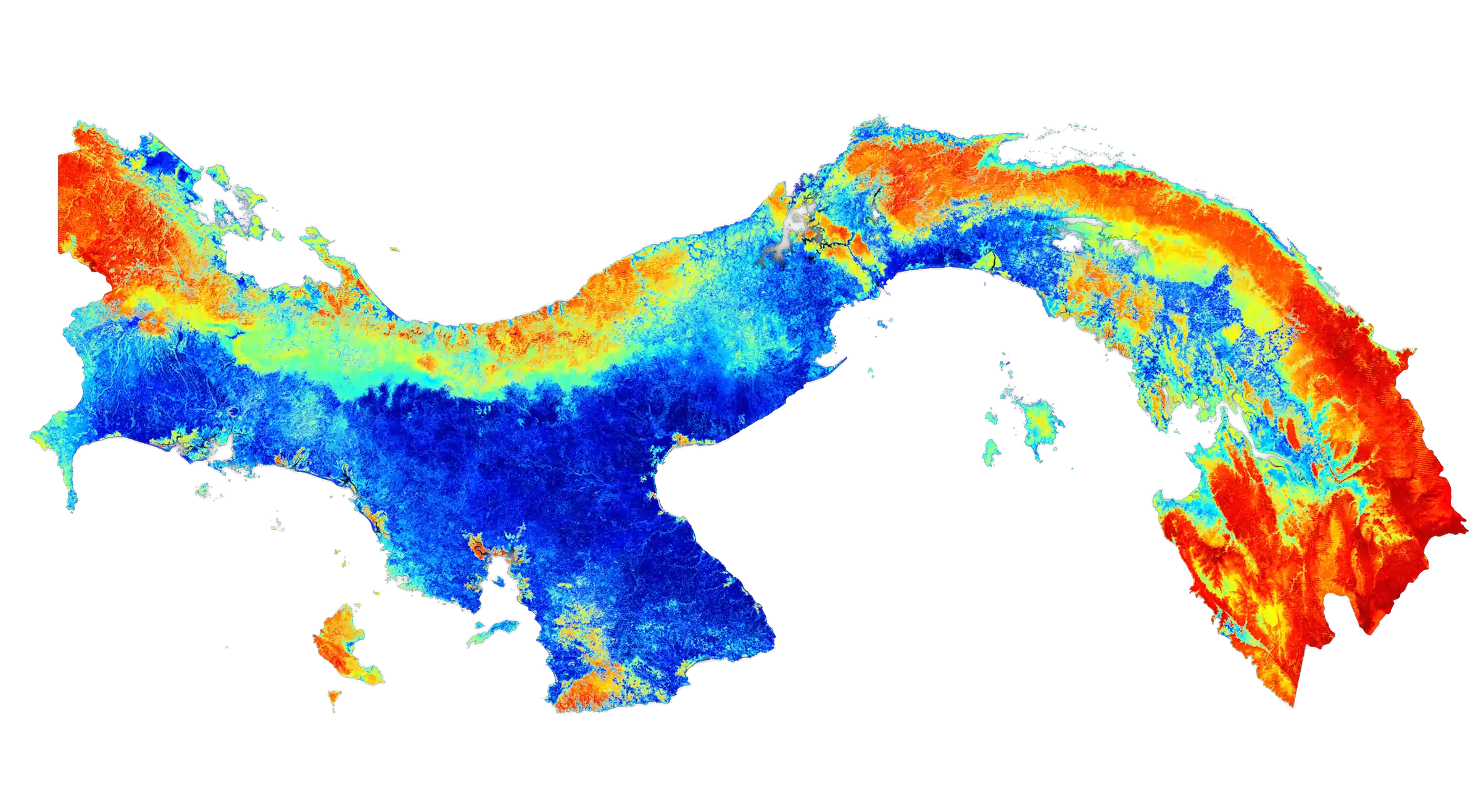
Working with the Smithsonian Tropical Research Institute, we mapped nearly 390,000 hectares at one-meter LiDAR resolution across the entire country. The Caribbean side held the highest carbon densities — humid old-growth forest with over 110 tons of carbon per hectare. Large deforested regions outside the Panama Canal watershed showed how human activity had reshaped the landscape. We also mapped primate habitats in the Darién — the same approach used in Borneo, identifying which forest types specific species depended on so conservation efforts could focus where they mattered most. One detail: we couldn't fly over certain Canal infrastructure. A military observer came up with us to make sure.
The Outcome
Panama became the proof of concept that national-scale carbon mapping was possible and scientifically defensible. The methodology was adopted as a model for other REDD+ nations. Carbon uncertainty was brought down to roughly 10% — the lowest of any method at the time. What we built in Panama rippled outward into climate policy across the tropics.