
What the Savanna Was Hiding
The Question
South African National Parks wanted to understand their savannas at a level of detail they'd never had before. How does 3D vegetation structure affect animal behavior? How should they manage fire to balance tourism visibility with habitat health? And were they right that elephant overpopulation required culling the herds?
What We Found
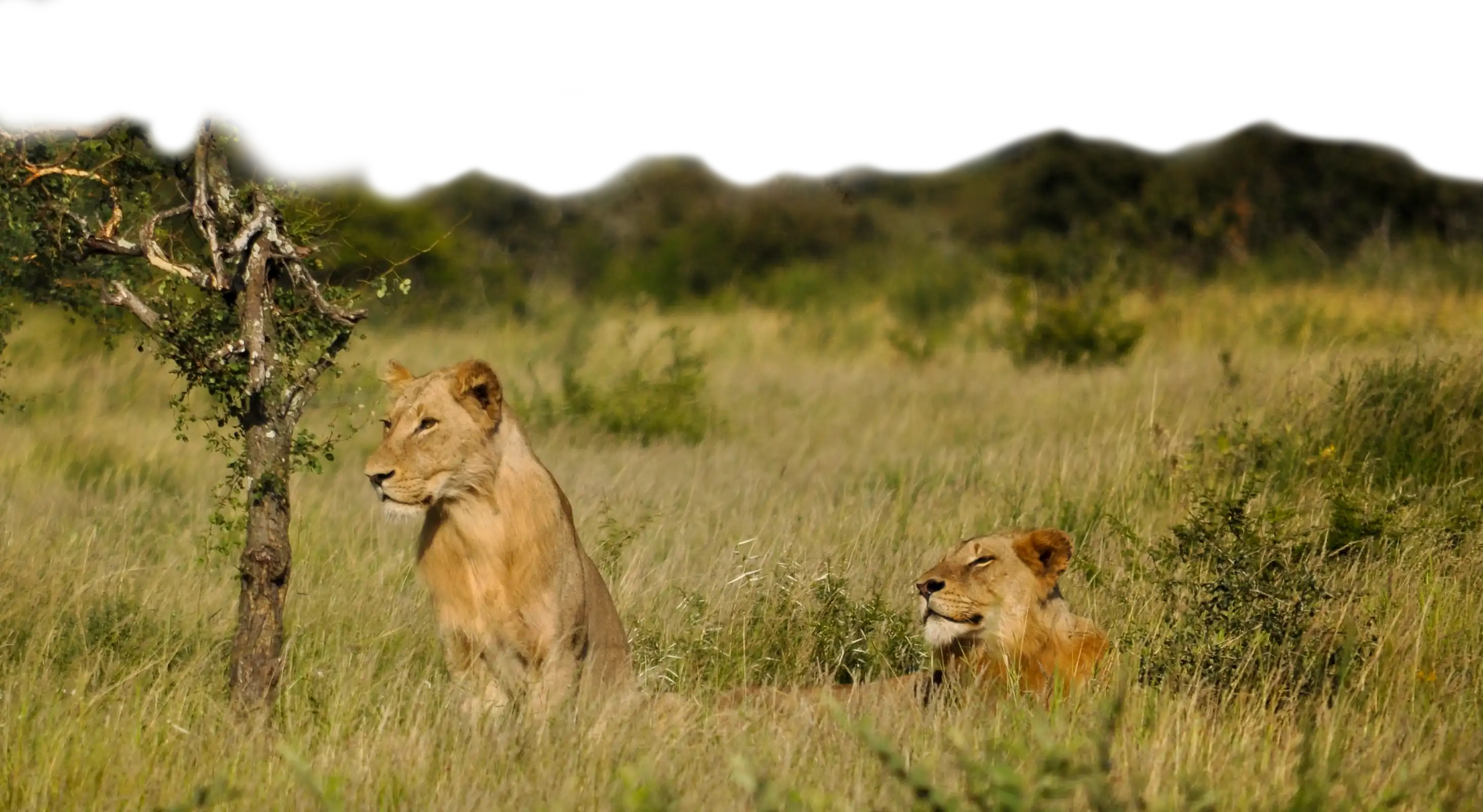
Seven years mapping Kruger, returning each April to build a continuous record of change. Telemetry collars on lions, elephants, and other species tracked against 3D habitat maps. The lion data overturned decades of assumption — males hunt ferociously, but only in dense vegetation where scientists couldn't observe them. They take down large prey in thick cover while females hunt in open savanna. Males aren't lazy. They're hunting where no one was watching. The elephant data was equally important. The problem wasn't total elephant numbers — it was distribution. They were overconcentrated in certain areas. Instead of culling, the park installed electrified wire to redistribute the herds. The habitat recovered without killing animals.
The Outcome
South Africa adopted new fire management regimes based on 3D vegetation mapping. They avoided mass elephant culling through spatial management. And they gained a new understanding of predator behavior that changed how they interpret savanna ecology. The South African park service operates at a level most countries can't match. Our job was to give them information worthy of that capability.